LACE UP YOUR BOOTS
Walks from
Pateley Bridge
Eight routes from the town centre and the dale beyond - from a flat riverside stroll to the full 53-mile Nidderdale Way.
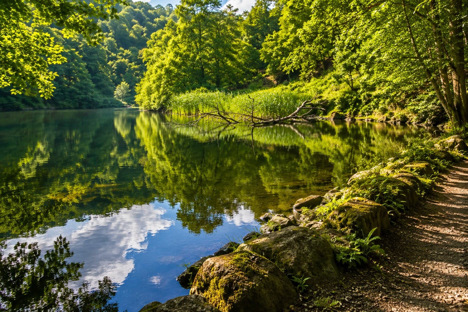
Riverside & Recreation Ground loop
The perfect first walk in the dale
A flat, easy walk along the River Nidd from the Recreation Ground, through meadows and riverside woodland. Suitable for pushchairs and dogs off lead.
Distance
1.5 mi
Time
45 min
Type
Loop
📍Start: Recreation Ground Car Park, Pateley Bridge HG3 5LG
Full walk guide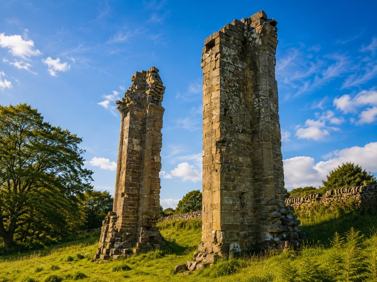
Yorke's Folly & Crocodile Rock
The view that stops everyone in their tracks
A steady climb out of Bewerley to the twin towers of Yorke's Folly and Crocodile Rock, with one of the best panoramic views in Nidderdale.
Distance
3 mi
Time
1.5 hr
Type
Loop
📍Start: Bewerley village, near Pateley Bridge
Full walk guide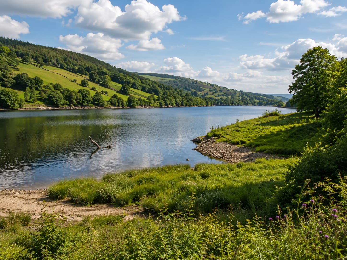
Gouthwaite Reservoir & Ramsgill
The birdwatcher's route up the dale
A flat there-and-back walk along the old railway line beside Gouthwaite Reservoir, one of the best birdwatching sites in the Yorkshire Dales.
Distance
6 mi
Time
3 hr
Type
There & back
📍Start: Gouthwaite Reservoir south end, near Wath
Full walk guide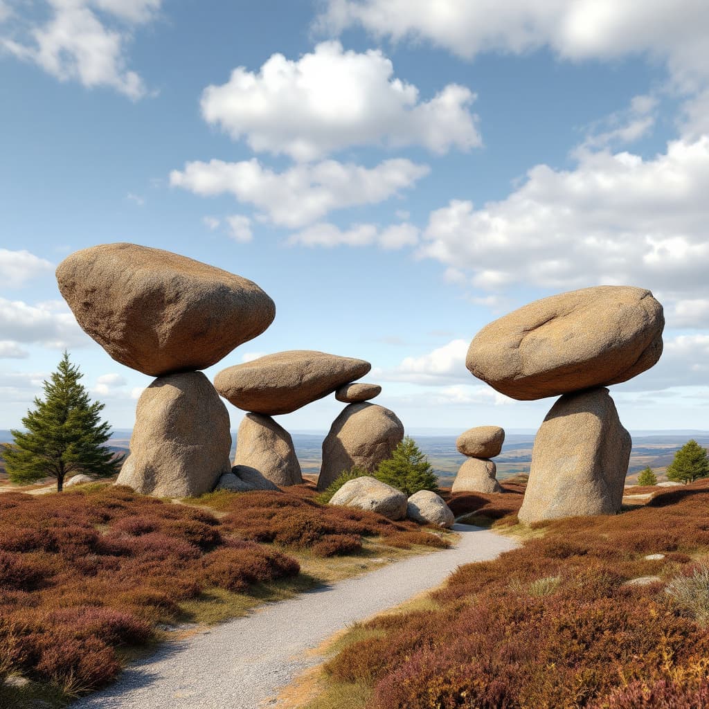
Pateley Bridge to Brimham Rocks
A walk to the strangest rocks in Yorkshire
A 4-mile walk from Pateley Bridge up through Glasshouses onto the moor, arriving at the extraordinary rock formations of Brimham Rocks on foot.
Distance
4 mi
Time
2 hr
Type
There & back
📍Start: Pateley Bridge town centre
Full walk guide
Coldstones Cut
The best view in the dale, with the shortest walk
A short walk from a roadside car park up to a striking dry stone land art earthwork, with one of the most complete panoramic views in the dale.
Distance
0.5 mi
Time
20 min
Type
Short walk from car park
📍Start: Roadside car park, B6265, Greenhow Hill
Full walk guide
How Stean Gorge
Yorkshire's Little Switzerland, on foot
Metal walkways through an 80ft limestone gorge, with a cave to explore and a rope bridge to cross. Paid entry, allow two hours.
Distance
1 mi
Time
2 hr
Type
Gorge circuit (paid entry)
📍Start: How Stean Gorge car park, Lofthouse, HG3 5SF
Full walk guide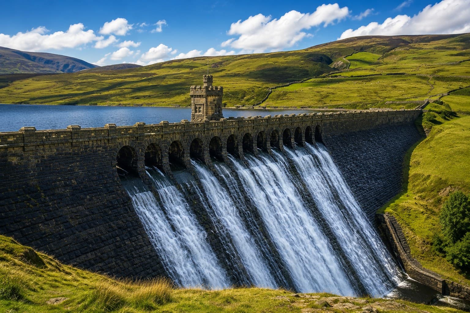
Scar House Reservoir circuit
The wildest walk at the head of the dale
A 7-mile circuit around Scar House and Angram Reservoirs at the wild head of the dale, taking in dam walls and the remains of a Victorian village.
Distance
7 mi
Time
3 hr
Type
Circular
📍Start: Scar House Reservoir car park, Lofthouse, HG3 5SG
Full walk guide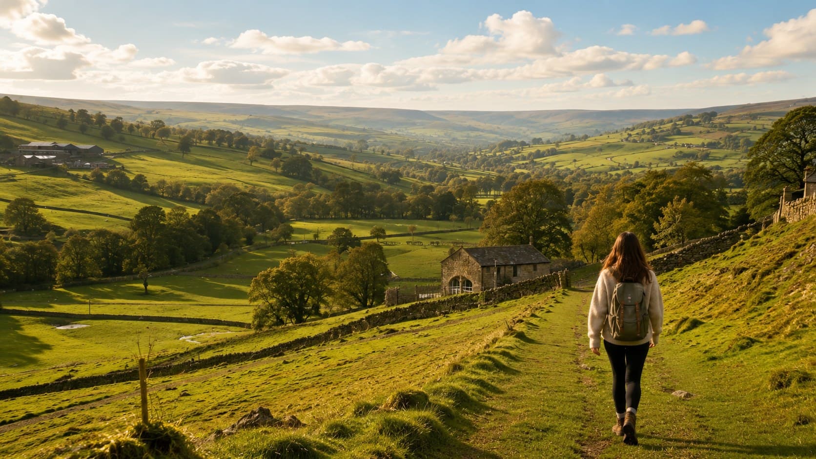
The Nidderdale Way
The full length of the dale, in stages
The full 53-mile circular route around the Nidderdale National Landscape, walked in stages over a long weekend.
Distance
53 mi
Time
3-4 days
Type
Circular
📍Start: Pateley Bridge town centre
Full walk guideAll eight walks on the map
Click a pin for walk details. Scroll to zoom.
WANT MORE?
Download the official Nidderdale Way guide
The Nidderdale AONB Partnership publishes a free PDF guide with OS map extracts, route descriptions and accommodation listings for all four stages.
More ways to explore the dale
See our full guide to things to do, check our dog-friendly walks and stops, or find out how to get here.